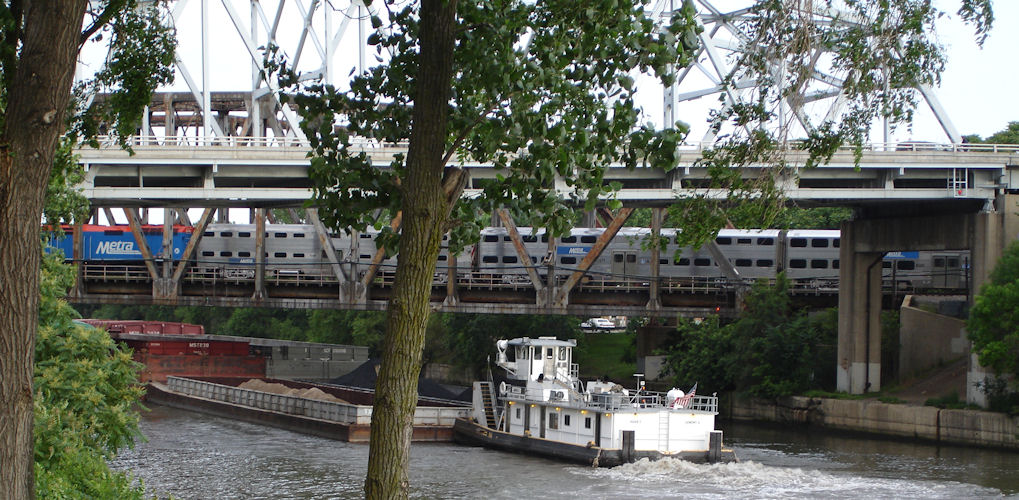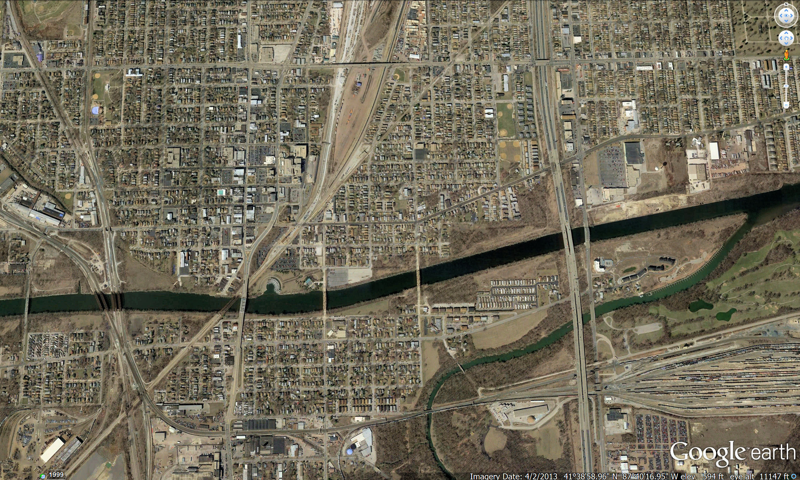
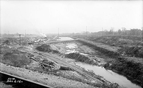
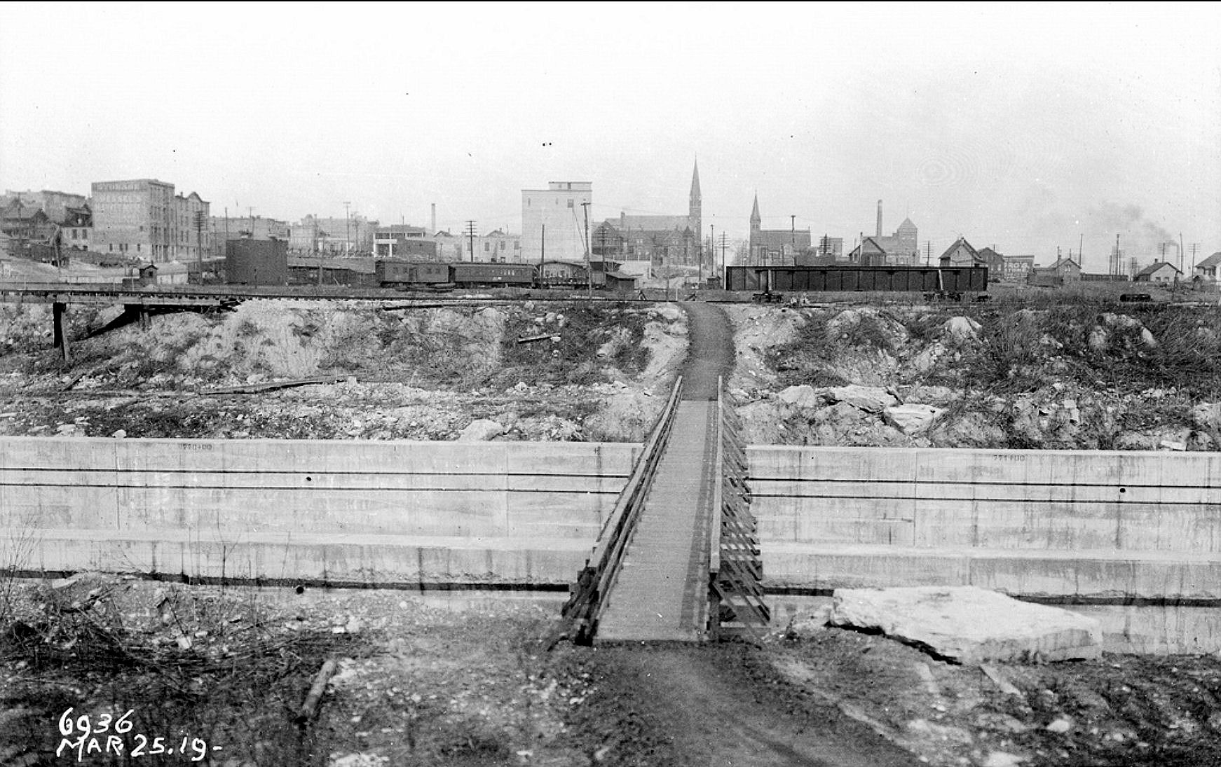
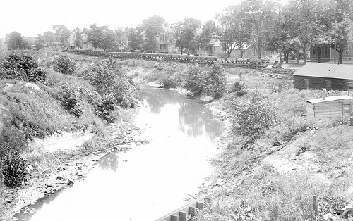
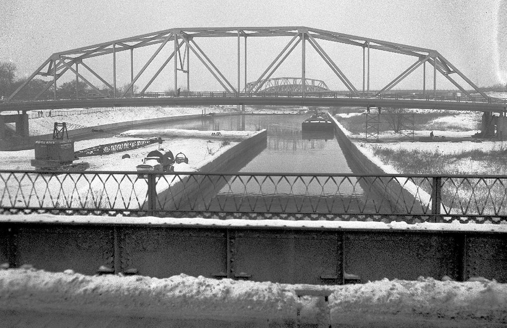
The 16-mile long Calumet-Saganashkee Channel (Cal-Sag Canal) begins at Fay's Point (far right) where Stony Creek (still visible west of the Western Avenue overpass) used to meet the Calumet River. Also still visible are the deteriorating remains of the bridge across Stony Creek to the site of the old Gas Plant and the "Blue Bridge" built on the site of the Feeder Creek Dam that used to lead to the Calumet Grove Forest Preserve.
Blue Island's Calumet Feeder Canal
Even before Tom Courtney and Norman Rexford arrived in Blue Island, planning for the construction of the Illinois and Michigan Canal had begun. When the I&M Canal opened in 1848, it connected the Great Lakes to the Mississippi River and the Gulf of Mexico. It ran 96 miles (154 km) from the Chicago River in Bridgeport, Chicago to the Illinois River at LaSalle-Peru. The canal crossed the Chicago Portage and helped establish Chicago as the transportation hub of the United States, before the railroad era. The I&M Canal was the first in a series of manmade canals and natural waterways that played a major role in the growth and development of the mid-western United States. During it's development, it was decided to build a dam on the Calumet River and dig a feeder canal near Blue Island to supplement water flow into the I&M Canal.
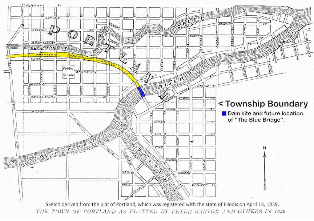 The path of the Blue Island Feeder Canal was planned for in the plat plan for Portland, Illinois in 1839
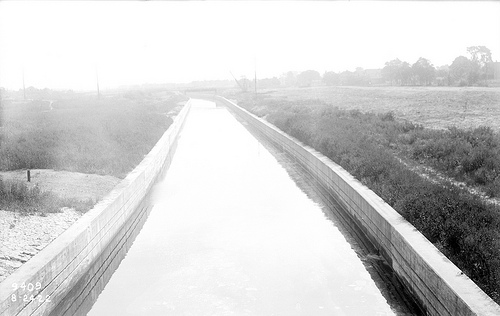
A survey for the canal route began in August of 1845 and the construction of the feeder canal began immediately after the survey was completed. The Feeder Canal was designed to be 40 feet wide at the water's surface, 26 feet wide at the bottom and have a depth of four feet. The dam across the Calumet River put the water in the feeder canal 10 feet above the level of the water in Stony Creek. Gates were provided so that the level of the water in the canal could be raised or lowered as needed. The first water from the Calumet River was turned into the Feeder Canal on June 12, 1849 and on July 22 of that year the first canal boat arrived in Blue Island. Merchandise and passenger traffic on the canal continued for nearly twenty years.
In 1871 the I&M Canal played a major role in a bold engineering feat - the reversal of the Chicago River. Sewage and other waste was being dumped into the Chicago River, which emptied into Lake Michigan and was polluting Chicago’s water supply. In an attempt to stop the spread of Cholera and Typhoid in Chicago, the canal was deepened, allowing the waters of Lake Michigan to flow down the canal and into the Illinois River. Residents of canal towns, afraid of diseases being brought by the canal, were furious, and complained of the terrible smell, and reduced property values.
In the 1870's, with river traffic on the decline as the railroad completed construction through the area and took over the transportation of goods and people, the importance of the canal system was greatly reduced. When the Sanitary and Ship Canal began operating it permanently reversed the flow of the Chicago River. Many people today confuse the much wider and deeper Sanitary and Ship Canal with the I&M Canal when they actually run parallel to each other. The Sanitary and Ship Canal also performed the same functions as the I&M - the shipping of bulk goods and the transport of sewage. In 1900 when the wider and shorter Chicago Sanitary and Ship Canal began operating, the I&M Canal became obsolete and it ceased transportation operations with the completion of the Illinois Waterway in 1933.
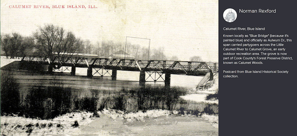
The use of the waters of the Calumet River as a supply for the Illinois and Michigan Canal was first suggested in 1830. The canal law of 1837 created the Calumet Feeder Canal and made it a part of the Illinois & Michigan Canal. Construction on the Calumet Feeder was completed in 1849. The additional water needed for the canal was supplied by building a dam in the Calumet River, fragments of which may still be seen under Roll's (Aulwurm / Blue) Bridge.
In the early 1870's other means were found to supply water to the Illinois and Michigan Canal and the Calumet Feeder Canal was abandoned by Canal Commissioners. The dam had caused flooding to farmers fields upstream of the dam in Indiana and for years caused animosity and numerous lawsuits until March of 1874 when the Illinois legislature passed "An Act to authorize the removal of the feeder dam across the Calumet River near Blue Island in the County of Cook, State of Illinois." In 1875, farmers whose land was being flooded became incensed at the delay of the dams removal and one night a group of 50 or more took matters into their own hands and blew up the hated dam.
||•Excerpted from: John Volp's The First Hundred Years Story of Blue Island 1835 - 1935
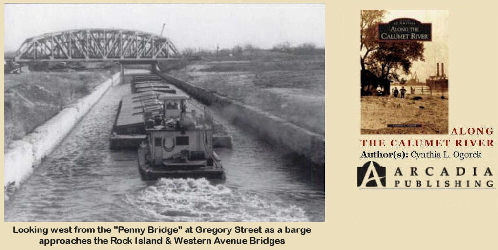
"Cal-Sag construction was completed in 1922. Until the opening of the Lakes-to-Gulf Waterway in 1933, however, it was not expected to be a commercial shipping route. It was only 60 feet wide, except for three passing places of 160 feet each, and at the Blue Island lock it was only 50 feet wide. Between 1933 and the early 1950's, however, shipments of commodities like oil, chemicals, and grain passed the formerly expected 1,000,000 tons per year by 450 percent. Careful dispatching and planned movements of opposing traffic during those years kept the barges moving safely in both directions, but the channel was not suitable for the "jumbo" barges that plied the Mississippi. (Photo courtesy of Blue Island Public Library.)" (© 'Along The Calumet River' ~ by Cynthia L. Ogorek)
The Cal-Sag Channel is a navigation canal in southern Cook County that serves as a channel between the Little Calumet River and the Chicago Sanitary and Ship Canal. It is 16 miles long and was dug over an 11-year period, from 1911 until 1922. The channel connects to the Little Calumet River on its eastern end, runs west past the Saganashkee Slough, and continues on west to the Chicago Sanitary and Ship Canal. The channel serves barge traffic in what once was an active zone of heavy industry in the far southern neighborhoods of the city of Chicago and adjacent suburbs. It is still being used as a conduit for wastewater from southern Cook County, including the Chicago-area Deep Tunnel Project, into the Illinois Waterway.
As Chicago was growing in the late 1800s, flood waters flushed pollution into Lake Michigan contaminating the drinking water supply, leading to thousands of deaths from waterborne disease. The Chicago Sanitary & Ship Canal and Cal-Sag Channels were completed in 1922 to help reverse the flow of water drainage from Lake Michigan into the Illinois River, thus protecting the Lake Michigan and providing clean lake water to dilute the pollution in the rivers. These and other changes shifted the natural drainage of the Calumet area from Lake Michigan back the opposite way toward the Illinois River. Today lakes and marshes have been filled in with slag and other waste materials to the point where some no longer exist. Lake Calumet itself used to extend to 98th Street and Woodlawn. But about a quarter of the lake has been transformed into land, and today the water’s edge is south of 103rd street. Some portions of Lake Calumet reach a depth of 30 feet, as compared with its natural six feet. (Twenty-seven feet is minimum depth of navigable waters for international trade.)
"When the formation of the Chicago Sanitary District was authorized by act of the Illinois State Legislature on May 29, 1889, the City of Blue Island was included within its borders. The purpose of the District, as its title indicates and as is more fully set forth in the charter, was to provide better sanitary, and consequently better health conditions for the cities and communities which comprise the District."
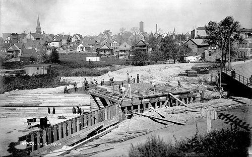
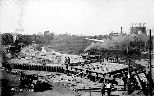
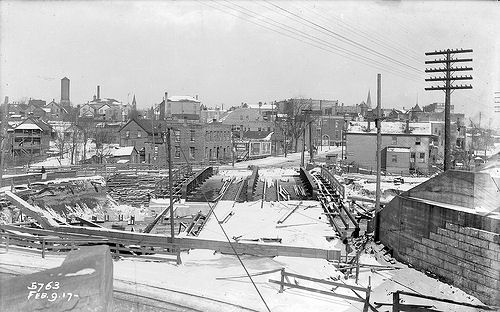
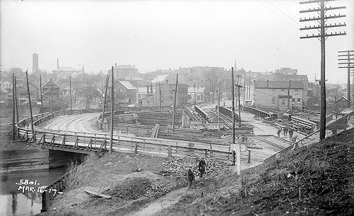
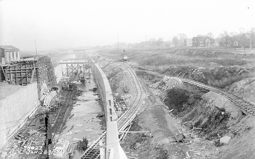
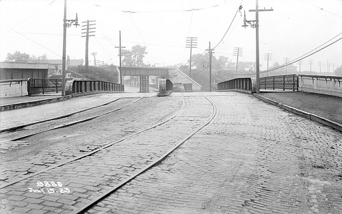
Early in 1900 surveys were made for the Calumet-Sag canal; two routes were surveyed — one, known as the "north route," through Blue Island; the other about one mile farther south, known as the "south route," passing across north Harvey. Eventually the north route (through Blue Island) was chosen and on August 6, 1906, the Blue Island City Council received and considered the first ordinance submitted by the Sanitary District for a franchise to construct the Calumet-Sag canal through Blue Island. By 1913, there was activity all along the line. Contractors were moving in and erecting machinery, bunk and storage shacks were being built. On July 4, 1913, the big steam shovel on the Green & Sons sections, near Worth, broke the first ground, thus officially starting construction of the Cal=Sag Canal.
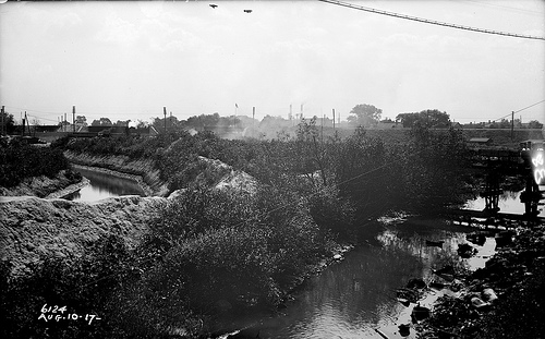
The construction work of the channel was divided into fourteen sections, averaging about one and one-eighth miles each. Beginning at the main channel above Lemont the section numbers continued east to the end of Section 14 at Fay's Point. The route of the canal from Ann street in Blue Island west is almost identical with that of the old feeder canal which was built in 1849 for the purpose of supplying additional water to the old Illinois and Michigan canal. From Ann street east to Fay's Point the canal follows exactly the bed of old Stony creek.
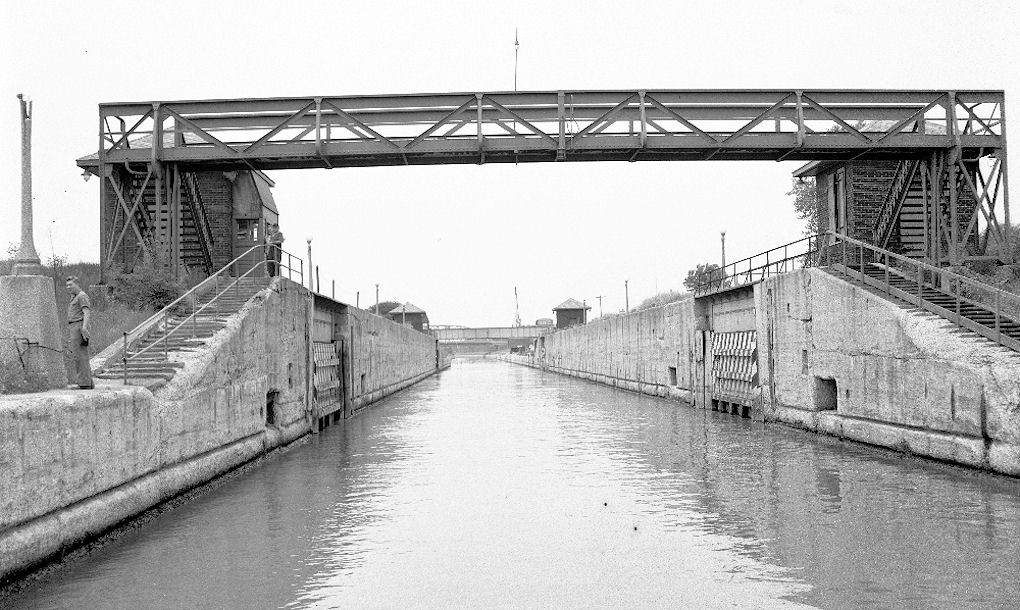
Since the canal is too narrow for large boats to pass each other, in 1935 a 160 foot wide lie-by was constructed every three miles. The controlling works located near the junction of the Channel and the Little Calumet river is a 50 foot wide lock consisting of two pairs of vertical sector gates 400 feet apart. Canal construction was completed on August 26. 1922.
||•Excerpted from: John Volp's The First Hundred Years Story of Blue Island 1835 - 1935
See: Blue Island Tour
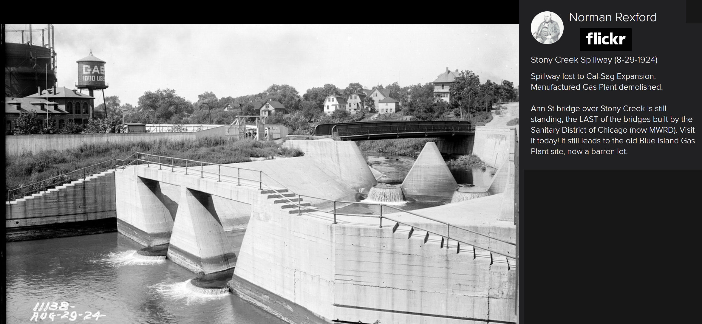
Photos: (© Norman Rexford / Flickr)
See also: Blue Island Canal Information
In the mid-1950s, the powers that be started calling for the widening of the Cal-Sag Canal because it was a "critical necessity since Chicago is going to be an important seaport" and a "vital link in the national defense plans". The U.S. Army Corps of Engineers was also promoting the widening project so that longer and wider barges could navigate past each other anywhere in the canal due to "an expected increase within the first five years of operation from the present 3.5 million tons of cargo handled to 8 million tons".
See: Cal-Sag Canal Widening Project
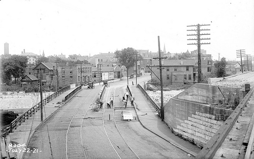
The multi-phased project began in 1956 and over the next few years the Cal-Sag Canal was widened from 60 feet wide to 250 feet. Work began in the Blue Island area in 1959 and was completed around 1965.
Photos: (© Norman Rexford / Flickr)
Ref.: Chapter VI - The Sanitary & Ship Canal, The Illinois Waterways & the Highways
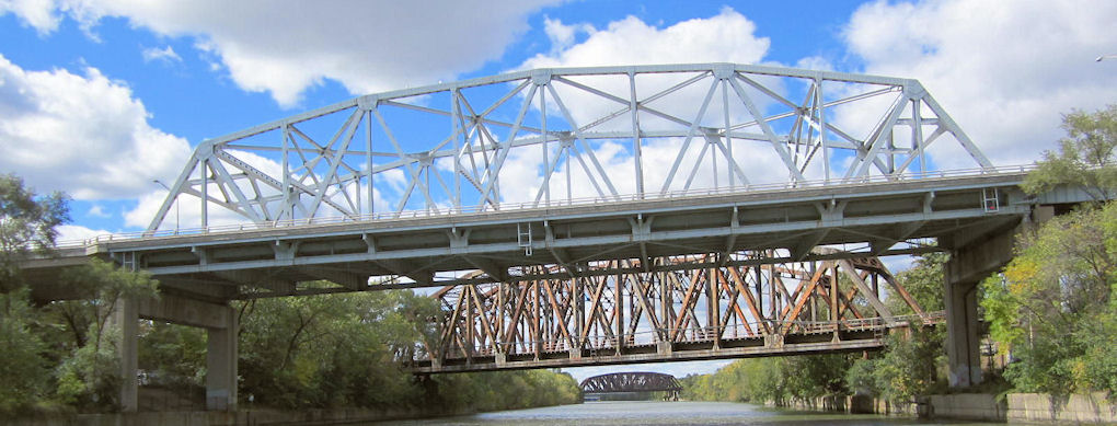
The Western Avenue Bridge built over the widened Cal-Sag Canal slashed Blue Island's business district and eviscerated the community's heart and soul. The community has been on the decline ever since...